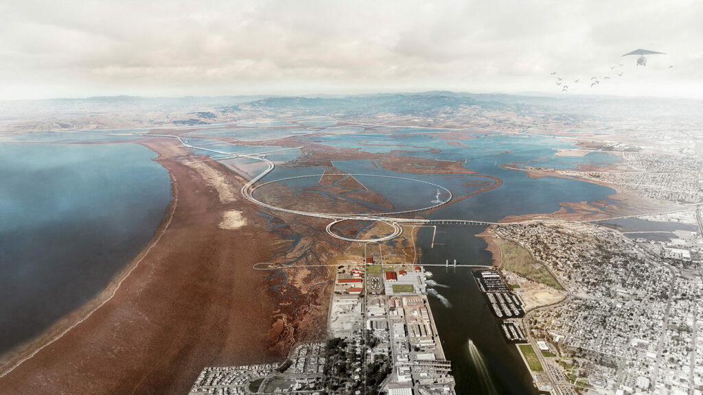
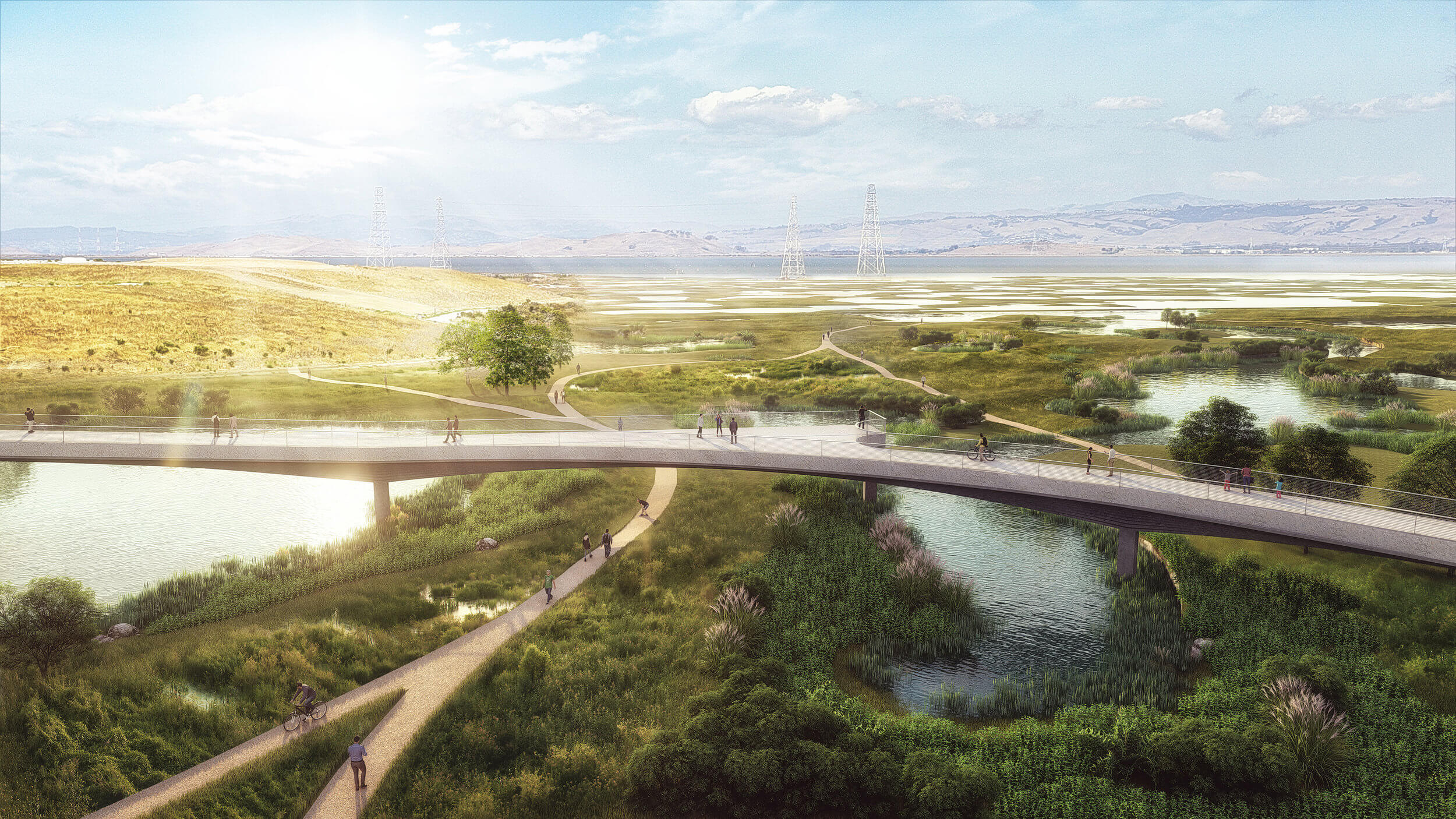
State Route 37, a low-lying commute route that skirts the northern edge of San Pablo Bay, is both traffic-choked and increasingly flooded due to sea level rise. Sitting atop a precarious levee that confines an immense but compromised marsh complex, Dr. Fraser Shilling of the UC Davis Road Ecology Center has observed, “the highway has the dubious distinction of constricting both traffic and tidal flows.” The project considers a new future for this highway as an elevated scenic byway, creating an iconic “front door” to a vast ecological open space previously known to few. Accessible to cyclists, runners, kayakers, campers, and fishermen, the Grand Bayway will become a Central Park with more 21st century sensibilities for rapidly expanding North Bay communities.
 TLS Landscape Architecture | Exploratorium | Guy Nordenson & Assoc | Michael Maltzan Arch| HR&A Advisors | Sitelab Urban Studio | Lotus Water | Rana Creek | Dr. John Oliver | Richard Hindle, UC Berkeley | Fehr & Peers Transportation Consultants