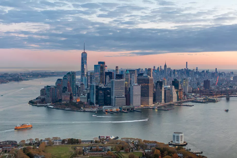
Curbed NY: The city is about to embark on a two-year process that will create a roadmap to expand nearly a mile of the lower Manhattan coastline into the East River with flood protections.
Officials with the New York City Economic Development Corporation (NYCEDC) have approved a team of 18 consultants lead by Arcadis, a Netherlands-based design and engineering firm, to develop the Financial District and Seaport Climate Resilience Master Plan. That framework will present locals with a handful of options for expanding the shoreline of those neighborhoods as much as 500 feet into the waterway with the goal of zeroing in on a single concept to defend the area against climate change. The team was assembled to encourage out-of-the-box thinking that officials hope will lead to an innovative approach.
“One of the reasons we really like this group of firms is their emphasis on being creative and bringing in ideas where possible to use natural systems, to think about the local ecology,” says Elijah Hutchinson, the vice president of waterfronts for NYCEDC. “And so a layered approach to resilience is going to be an important one here.”
Arcadis is no stranger to New York City resiliency efforts; the firm is currently working on the East Side Coastal Resiliency (ESCR) project north of the proposed shoreline extension. Another Dutch-based consultant on the team, Deltares, was also recently brought on by Manhattan Borough President Gale Brewer and City Council member Carlina Rivera to independently review the city’s plans for the ESCR project. Other consultants that are familiar names on city projects include SHoP Architects, One Architecture & Urbanism,and SCAPE.
The master plan is building off of a $10 billion proposal unveiled by Mayor Bill de Blasio in March that positioned the effort as part of a multi-pronged plan to prevent storm surge and rising sea level from inundating Manhattan. The Seaport and Financial District pose an especially daunting challenge, NYCEDC officials say, because of the area’s low-lying topography—it’s just eight feet above sea level—and the web of crucial transportation and sewage infrastructure below, which makes digging down unfeasible. Read more>>