After Superstorm Sandy, reclaiming the waterfront is a many-layered thing
Architecture Boston: When Superstorm Sandy hit the Lower East Side of Manhattan in October 2012, it changed the lens through which designers need to approach neighborhoods vulnerable to climate change. The storm surge combined with spring’s high tide created a flood event 4 feet higher than any previously recorded storm. In the months that followed, it was evident that relief and recovery alone would not be a sufficient response to this disaster. As landscape architects, we realized we would need to weave education—our own and the community’s—into our design process to achieve more robust landscapes that are capable of performing at multiple levels, landscapes that stretch beyond the beautiful and functional to those that strengthen ecological systems.
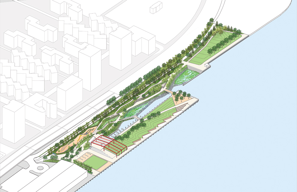
This is a story about designing a public waterfront park, Pier 42, while managing complexities of information and design triggered by a catastrophic event, trauma, and divergent regulations that contribute to the challenge of building a more resilient city. Pier 42 is located along Manhattan’s East River, roughly between the Manhattan and Williamsburg bridges. The Lower East Side is a dense, diverse community with a total population of 72,000. Its shoreline is retained by a stone bulkhead constructed in the late 1800s, roughly 5 feet below the current 100-year floodplain. Not surprisingly, the areas within the city that experienced the worst inundation during Sandy were those built on landfill along the coast, and further inland, where there had once been marshes or streams. Much of the Lower East Side was built on landfill, and floodwaters traveled almost 2,000 feet inland. READ MORE>>