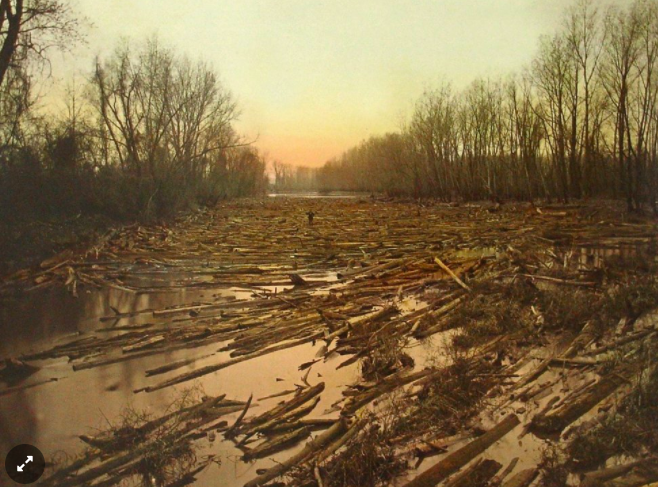
Places Journal: In 1839, if you wanted to take a boat from coastal Matagorda, Texas, to the inland town of Wharton, you would have had a problem. A massive tangle of trunks, roots, and branches, colonized by silt and new live trees, jammed the river for miles. Such log rafts were common on rivers that crossed the alluvial plains, where the slackwater did not flow fast enough to sweep away the debris from floods on the upper stretches. And once a raft had grown to a certain size, it might stick around for decades, as new arrivals replaced the logs that rotted or fell off the fringe. 1 By 1852, the young state of Texas had had enough. Riverboats were then the most important transportation technology in the American West, and the Matagorda raft was choking the life out of upriver counties. So the state paid the U.S. Army Corps of Engineers, which had been conscripted into infrastructure work by the General Survey Act, to cut a side channel around the raft. Unfortunately, nobody bothered to fund its maintenance, and soon the bypass was clogged, too. 2
By the 1920s, the raft had grown to over 40 miles long, causing destructive floods in riverside towns. Their desperate residents, banding together as the Matagorda and Wharton county reclamation districts, cut away a section of the east bank, dynamited the thickest part of the raft, and let floodwaters push the rest downstream, where the tangled trees promptly formed a new mass at the river’s mouth on shallow Matagorda Bay. Fed by a continual flow of sediment and debris, the delta grew by 500 acres a year, impeding navigation, until it stretched all the way to the barrier island that separated the bay from the Gulf, effectively closing off the port of Matagorda. 3
Determined to solve this landscape once and for all, the counties in 1934 dredged a straight line — 9 feet deep, 200 feet wide, 6 miles long — from the old river mouth, through the log delta, and across the barrier island, connecting the river directly to the Gulf for the first time. They placed the dredged spoils on either side of the channel and built levees to keep the passage clear, and in 1937 they turned over this infrastructure to the federal Army Corps of Engineers, which maintains it to this day as part of the Gulf Intracoastal Waterway, a network of navigable bays and canals that stretches from Texas to Florida. Read More>>

