Battle on Many Fronts
SF Chronicle: The levee that rings Oakland International Airport seemingly has nothing in common with the salt-crusted stretch of flat land alongside Menlo Park’s Bayfront Park.
One is a 7-foot-high line of boulders, an engineered barrier between the tidal flows that surge in through the Golden Gate twice daily and the runways used by 10,000 commercial flights every month. The other is quiet desolation, a white void dotted with stagnant pools of water.
Both, though, are examples of the Bay Area shoreline at risk from the long-term effects of sea level rise — and reminders that there’s no single way to prepare for what might lie ahead.
The correct remedy in some areas of shoreline will involve forms of natural healing, with restored and managed marshes that provide habitat for wildlife and trails for people. But when major public investments or large residential communities are at risk, barriers might be needed to keep out water that wants to come in.
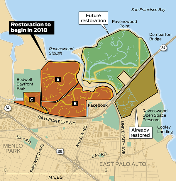
It’s a future where now-isolated salt ponds near Silicon Valley would be reunited with the larger bay, while North Bay farmland is turned back into marshes. Levees that protect the lagoon-sliced suburb of Foster City likely would grow higher, as would the Oakland airport’s seawall. Read more>>