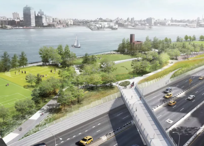
Curbed: The city has announced major changes to the design for part of the East Side Coastal Resiliency Project (ESCR), a proposal that has been in the works for several years and aims to protect against catastrophic flooding by building a “resilient park” along the East River from Montgomery Street on the Lower East Side to East 25th Street. The alternative design scraps roughly 70 percent of the city’s previous version and will reportedly reduce construction time, while also delivering flood protections nearly a year earlier than projected.
According to city officials, the new plan will shave about six months off of the projected timeline and will be less disruptive for residents living in the area, since the design shifts closer to the East River and further away from the FDR Drive. Despite the shift, the design still maintains a focus of protecting against projected storm surges for 2050. “The goal is the same and this design is actually an enhancement of that goal,” said First Deputy Mayor Dean Fuleihan. “The Department of Design and Construction came to the conclusion that [this project] could be done in a better, quicker way, and it’s working.”
At a March 2018 community board meeting, officials presented the design, which was a collaboration between the city, AKRF, One Architecture, Mathews Nielsen Landscape Architects, and Bjarke Ingels Group. Community members noted that the plan needed a wider path on its pedestrian bridge across Delancey Street and that the playground on East 10th Street could benefit with a few resilient upgrades of its own, among other things. Check it out >>

